Skip to content
Nature / Seismology / Earthquakes
Earthquakes in Italy
<a href="https://commons.wikimedia.org/wiki/File:L%27Aquila_eathquake_prefettura.jpg">TheWiz83 at it.wikipedia</a>, <a href="http://creativecommons.org/licenses/by-sa/3.0/">CC BY-SA 3.0</a>, via Wikimedia Commons

Earthquakes in Italy

Published:

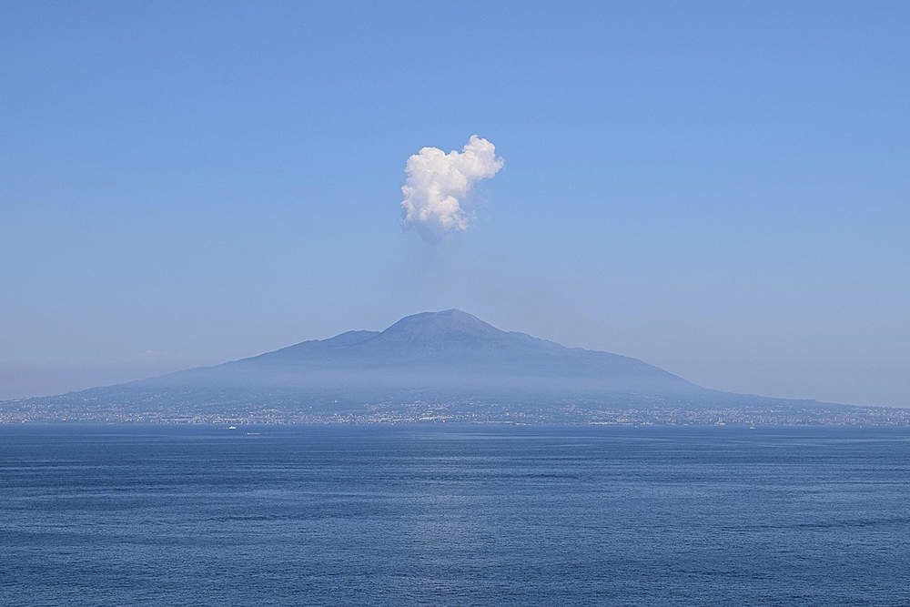
Italy sits in one of the most seismically active regions of Europe because it lies on the boundary where the African and Eurasian tectonic plates collide. This collision causes intense geological stress along the Apennine Mountains and other fault systems throughout the country.

As a result, Italy experiences frequent seismic events, ranging from small tremors to devastating quakes that reshape entire towns. The Apennine range is especially active because it is part of a zone where the crust is being pulled apart and compressed at the same time.

Historical Earthquakes That Shaped Italy

Italy has a long record of major earthquakes, many of which have caused tragic losses and historic changes. The 1908 Messina earthquake remains one of the deadliest in Europe, killing over 100,000 people and destroying vast parts of Sicily and Calabria.

Other catastrophic quakes include the 1980 Irpinia earthquake, which killed nearly 3,000 people, and the 2009 L'Aquila event, which devastated central Italy and displaced tens of thousands. Each major quake has exposed both geological vulnerabilities and weaknesses in infrastructure.

Regions with the Highest Seismic Risk

The central Apennines are considered the most hazardous area in terms of seismic risk. This mountainous belt stretches through much of central Italy and has been the site of many deadly quakes in recent decades. The region�s unique tectonic activity creates long fault lines prone to sudden ruptures.

Southern Italy also carries high seismic potential due to the complex interactions between different geological faults. Northern areas, including parts of the Alps and Po Valley, are less active but still at risk. Seismic hazard maps show that most of Italy is exposed to moderate or high earthquake risk.

The Science Behind Earthquakes in Italy

Italy's seismicity is driven by the ongoing subduction of the African Plate beneath the Eurasian Plate. This process creates pressure that is periodically released through earthquakes along active faults. Some faults can remain dormant for centuries before suddenly rupturing.

Modern geology uses GPS data, satellite imagery and seismometers to monitor these movements in real time. Scientists also study sedimentary layers and historical records to understand long-term patterns of seismicity across the Italian landscape.

Impact on Cities and Infrastructure

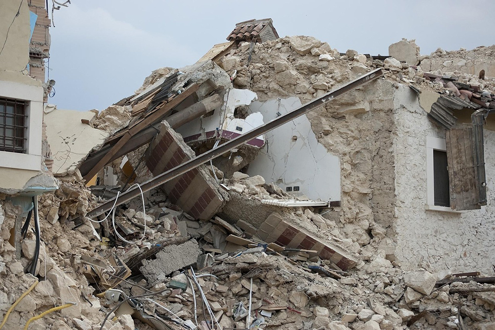
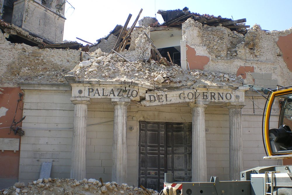
Earthquakes have had a major impact on Italian architecture and infrastructure. Many historical towns were built centuries before seismic building codes existed, making them particularly vulnerable. When earthquakes strike, older stone buildings often collapse entirely.

Modern cities have gradually improved building standards but challenges remain. Retrofitting old buildings, preserving cultural heritage and upgrading public facilities to resist tremors is costly and time-consuming. Rural and mountainous regions are especially exposed to the effects of large quakes.

The Role of the INGV and National Planning

The National Institute of Geophysics and Volcanology (INGV) plays a key role in monitoring seismic activity across Italy. It operates a dense network of seismic stations and publishes real-time data, risk maps and research findings for public and governmental use.

The Italian government has also developed long-term national emergency plans for earthquake response. These include public education programs, evacuation training and funding for the reinforcement of schools and hospitals in high-risk areas.

Modern Warning Systems and Preparedness

Italy does not yet have a full-scale early warning system like those in Japan or Mexico, but it is making significant strides. Pilot systems can now detect initial seismic waves and send alerts seconds before the stronger shaking starts, giving people time to take cover.

Smartphone apps, civil defense sirens and text message systems are being tested and expanded. Schools regularly conduct earthquake drills and civil protection units work to educate citizens on how to act during a seismic event.

Cultural and Social Impact of Earthquakes

Earthquakes have left deep scars not only in Italy's physical environment but also in its collective memory. Survivors often recount the emotional toll of losing homes, communities and loved ones. Whole towns have been abandoned and rebuilt multiple times throughout history.

The 2016 Central Italy earthquake sequence, which struck towns like Amatrice and Norcia, reminded the nation of its vulnerability. Yet it also sparked solidarity and resilience, with thousands of volunteers helping to rebuild communities brick by brick.

Rebuilding and Future Resilience

Post-earthquake recovery in Italy is a complex process that blends engineering, heritage conservation and economic planning. Rebuilding must meet modern seismic standards while respecting traditional architecture and historical significance.

In recent years, Italy has increased its investment in seismic retrofitting and urban planning. Incentives like tax credits for structural upgrades and government-funded renovation programs aim to make buildings more resilient and reduce future damage.

Conclusion: Living with Seismic Risk in Italy

Italy's geography ensures that earthquakes will remain part of its natural reality. While science cannot yet predict earthquakes with certainty, growing knowledge and better infrastructure have already saved lives. The future lies in ongoing vigilance and adaptation.

Public awareness, scientific research and political will must all work together to reduce Italy's seismic vulnerability. With proper planning and commitment, the country can face its seismic challenges while preserving its history and protecting its people.

Major Earthquakes in Italy

Italy — major earthquakes (selected timeline)
Date
Location
Deaths
Mag.
08/09/1905
Capo Vaticano, Calabria (offshore)
Deaths: 527
Magnitude: 7.9
28/12/1908
Messina, Sicily
Deaths: 70,000
Magnitude: 7.2
13/01/1915
Avezzano, Abruzzo
Deaths: 32,610
Magnitude: 7.0
29/06/1919
Mugello, Tuscany
Deaths: 100
Magnitude: 6.3
07/09/1920
Garfagnana, Tuscany
Deaths: 171
Magnitude: 6.4
23/07/1930
Irpinia, Campania
Deaths: 1,404
Magnitude: 6.5
15/01/1968
Salaparuta, Sicily
Deaths: 260
Magnitude: 6.5
06/05/1976
Gemona del Friuli, Friuli–Venezia Giulia
Deaths: 1,000
Magnitude: 6.5
23/11/1980
Irpinia, Campania
Deaths: 3,000
Magnitude: 6.5
26/09/1997
Annifo, Umbria
Deaths: 11
Magnitude: 6.4
06/09/2002
Palermo, Sicily (offshore)
Deaths: 2
Magnitude: 6.0
31/10/2002
San Giuliano, Molise
Deaths: 29
Magnitude: 5.9
06/04/2009
L'Aquila, Abruzzo
Deaths: 295
Magnitude: 6.3
20/05/2012
Finale Emilia, Emilia Romagna
Deaths: 7
Magnitude: 6.1
29/05/2012
Medolla, Emilia Romagna
Deaths: 20
Magnitude: 5.8
24/08/2016
Accumoli, Lazio
Deaths: 298
Magnitude: 6.2
18/01/2017
Central Italy
Deaths: 34
Magnitude: 5.7

For up to date monitoring and a complete daily record, see List of daily seismic events in Italy.

Map showing seismic zones and earthquake risk areas in Italy
Seismic zones in Italy. Risk varies by region, with higher hazard in parts of the Apennines and the south.

Natural Systems

Nature icon

Nature

A compact reference to Italy’s natural systems — land, climate, seismic forces, and living environments — designed to sit beneath articles.

Geography Climate Seismology Biodiversity
Italy natural landscape
Mountains, plains, coastlines, and islands — the physical systems that shape climate, life, water, and natural risk.

Italy — nature snapshot

Stable reference signals for quick environmental orientation.

Terrain

Highly varied

Alps in the north, an Apennine spine through the peninsula, large plains, long coastlines, and major islands. Sharp contrasts can occur over short distances, creating strong local “micro-regions.”

Climate

Multi-zone

Mediterranean patterns dominate many coasts, with alpine conditions at altitude and more continental influence inland. Latitude, elevation, and exposure shape rainfall, temperature, wind, and seasonality.

Volcanism

Active systems

Volcanic landscapes appear both as islands and mainland zones. Risk and monitoring focus on specific volcanic areas rather than being uniform nationwide.

Earthquakes

Frequent

Italy sits in an active tectonic setting, so seismicity is a persistent national reality. Exposure varies by region, with building standards and local geology strongly affecting impacts.

Water

Seasonal

Rivers and lakes structure settlement and corridors, while rainfall and snowpack drive seasonal availability. Drought, floods, and water management pressures can intensify during extreme seasons.

Coasts

Extensive

Long coastlines create maritime climates, wetlands, dunes, cliffs, and port landscapes. Coastal zones also concentrate tourism and infrastructure, increasing sensitivity to erosion and storm events.

Habitats

Dense mosaic

Alpine forests, Mediterranean scrub, wetlands, river plains, high meadows, and island ecosystems coexist in tight space. This habitat variety supports strong biodiversity and regional specialisation.

Key risks

Multiple

Earthquakes and volcanic activity combine with hydro-meteorological risks: floods, landslides, wildfire, and heat stress. Most impacts are local, but climate extremes can produce national-scale disruption.

Geography

A compressed landscape

Italy packs major terrain types into a narrow footprint: alpine massifs, a long mountain spine, broad plains, volcanic zones, and extensive coasts. This compression produces strong local contrasts in vegetation, agriculture, settlement density, and mobility — even between neighbouring valleys or coastlines. For readers, “place” often equals “terrain,” because terrain dictates climate, water, and the rhythm of life.

Climate

Mediterranean, alpine, continental

Climate shifts quickly with latitude and altitude, producing warmer maritime coasts, colder mountain zones, and more continental interiors. Rainfall patterns vary widely: some areas are shaped by winter storms, others by summer dryness, and many by sharp seasonal transitions. Exposure and microclimates matter — wind corridors, lake effects, and mountain barriers often explain local conditions better than a national average.

Seismology

An active boundary zone

Italy sits in a tectonically active setting, which is why earthquakes are recurrent and why volcanism remains a live factor in certain regions. Risk is uneven: geology, local ground conditions, and building stock can amplify or reduce impacts. The practical takeaway is preparedness — monitoring, building standards, and land-use planning are part of living sustainably in this landscape.

Biodiversity

High diversity, tight space

Italy’s habitat mosaic supports rich plant and animal life, including alpine species, Mediterranean specialists, wetland communities, and island endemics. Many ecosystems are closely interlocked, so change in water regimes, temperature extremes, or land management can cascade quickly. Conservation is therefore both about protected areas and about how farmland, forests, rivers, and towns connect as an ecological network.

Italy geography
Geography
Italy climate
Climate
Italy seismic activity
Seismology
Italy biodiversity
Biodiversity
Italy flora and fauna

Flora & Fauna

Plants, animals, and habitats

Italy’s living environment ranges from Mediterranean scrub and coastal wetlands to alpine forests, high meadows, and island ecosystems. This supports a wide spectrum of birds, mammals, reptiles, and insect life, alongside regionally distinctive plant communities shaped by altitude and water availability. Many iconic landscapes are “worked nature” — forests managed over time, agricultural mosaics, and grazing zones — so biodiversity often depends on both protection and sustainable land practice.

Italy natural risk and adaptation

Natural Risk

Living with instability

Italy’s risk profile combines geological hazards (earthquakes and volcanic activity) with climate-linked threats such as floods, landslides, wildfire, and heat stress. Impacts are usually local, but can be severe where steep terrain, dense settlement, and infrastructure corridors intersect. The modern response is continuous: monitoring and early warning, resilient construction, water and slope management, and practical adaptation for hotter, more extreme seasons.