Skip to content
Places / National Parks / Gran Paradiso National Park
Gran Paradiso

Gran Paradiso

Published:

The Gran Paradiso National Park is located in the Graian Alps in north west Italy, stretching across the regions of Aosta Valley and Piedmont. It is 703 square kilometres in area and, combined with the adjacent Vanoise National Park of France, it makes up the largest protected area in Europe.

Gran Paradiso National Park
click to enlarge

The origins of the National Park date back to before the unification of Italy, when Victor Emmanuel, later to become the first king of Italy, created a Royal Hunting Reserve in 1856. He was concerned that the uncontrolled hunting of the Alpine Ibis had led to an alarming decrease in their numbers. Later, in 1920, Victor Emmanuel's grandson, king Victor Emmanuel III, donated the original 21 square kilometres of land to create what was the first National Park in Italy.

When the park was first created, there were 4,000 Alpine Ibex within its boundaries. However, poaching continued until 1945, by when the numbers had dropped to 419. since then, increased protection has restored their numbers back to the original 4,000.

The national park is named after the mountain of the same name, the only mountain over 4,000 metres located entirely on Italian territory. The Mont Blanc massif lies across the border between Italy and France, and the Matterhorn, along the border between Italy and Switzerland.

As well as the Alpine Ibex, the park also provides a safe haven for the Ermine, Weasel, Hare, Eurasian Badger, Alpine Chamois, Wolf and Lynx. Bird species include: the Urasian Eagle-owl, Rock Ptarmigan, Alpine Accentor, Chough, Golden Eagle, Wallcreeper, Black Woodpeckers and Nutcrackers.

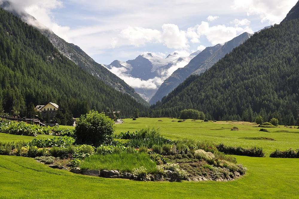
The terrain in the National Park is a mixture of forest, Alpine meadow and mountain terrain. The altitude ranges from 800 metres to over 4,000 metres, and there are 57 glaciers within its boundaries.

Places Dossier

Places icon

Italy

A compact place-reference: regions, settlements, landscapes, protected areas, and heritage — designed to sit beneath articles.

Regions Towns & Cities Landscapes Heritage
Italy — places feature image
Italy by territory: how the country breaks down, what to look for, and how landscapes and heritage shape the map.

Italy — places snapshot

Stable reference signals for quick geographic orientation.

Regions

20

Five have special autonomous status, reflecting distinct languages, history, and geography. Regions shape administration, services, and identity — often the most useful “map unit” for travellers and readers.

2nd-level

110

Provinces and metropolitan city authorities that coordinate planning, roads, schools, and territorial services. The role varies by area, but they remain a key layer between region and comune.

Comuni

7,904

The municipal building blocks of Italy — cities, towns, villages, and mountain communities. Local identity is strongly comune-based, and many services and permissions are handled at this level.

National parks

25

State-level protected areas covering alpine massifs, forests, volcanic zones, islands, and coastlines. They anchor biodiversity protection and define some of Italy’s most distinctive natural landscapes.

Highest peak

~4,806 m

Mont Blanc (Monte Bianco) on the border with France — the highest summit in the Alps. Italy’s high mountains influence climate, watersheds, and seasonal travel patterns across the north.

Largest lake

~370 km²

Lake Garda, spanning multiple regions, is the largest Italian lake by surface area. Northern lakes act as microclimate zones and long-standing settlement and resort corridors.

Longest river

652 km

The Po runs west–east across the northern plain, shaping agriculture, industry, and major transport routes. It defines Italy’s largest lowland system and a dense belt of settlement and production.

UNESCO

61

World Heritage properties spread across historic centres, archaeological sites, cultural landscapes, and natural areas. The density of listed places makes heritage a visible, lived layer of the national territory.

Regions

Twenty Italies, one map

Regions are the primary lens for variation: dialects, food cultures, building styles, and everyday rhythms often track regional boundaries. They also structure administration and public services, so “where you are” has practical effects as well as cultural ones. For orientation, region is often the fastest way to understand the landscape, the cuisine, and the character of a place.

Towns & Cities

A network of centres

Italy is organised as a network of historic cities and thousands of comuni rather than a single dominant urban core. Larger cities concentrate infrastructure and institutions, while smaller towns preserve local craft, festivals, and distinctive street patterns. This creates short-distance variety: a few kilometres can shift language, architecture, food, and landscape.

Landscapes

Mountains, plains, coasts

The Alps and Apennines frame the country, with plains, lakes, islands, and long coastlines producing sharp local contrasts. Terrain shapes climate, agriculture, and settlement density — and it also governs travel time far more than straight-line distance suggests. Italy’s landscape is best read as a mosaic of micro-regions, each with its own feel and seasonal rhythm.

Heritage

Layers you can visit

Heritage in Italy is embedded: Roman routes, medieval walls, and Renaissance centres are often part of living neighbourhoods. Archaeology appears both as major sites and as fragments — a column, a gate, a street plan — folded into modern life. The experience is less “museum-only” and more a continuous encounter with past layers in active places.

Italy regions
Regions
Italy towns and cities
Towns & Cities
Italy landscapes
Landscapes
Italy heritage sites
Heritage
Italy national parks, lakes, rivers and mountains

Natural

Parks, peaks, water, islands

Italy’s protected landscapes range from alpine ridgelines and deep forests to volcanic terrain and island coastlines. National parks anchor biodiversity and define some of the country’s most iconic routes and viewpoints, while lakes and rivers organise settlement and mobility corridors. The natural map explains climate shifts, local agriculture, and why certain places became historic crossroads, resort zones, or remote refuges.

Italy archaeological sites

Archaeology

From ruins to living streets

Archaeology in Italy is geographic: Greek colonies in the south, Etruscan centres in central regions, Roman infrastructure nationwide, and medieval layers almost everywhere. Some sites are monumental, but many traces appear as everyday fragments — walls, gates, amphitheatres, road alignments — integrated into modern towns. This is why “place” in Italy often includes time: landscapes and settlements carry multiple eras in the same view.