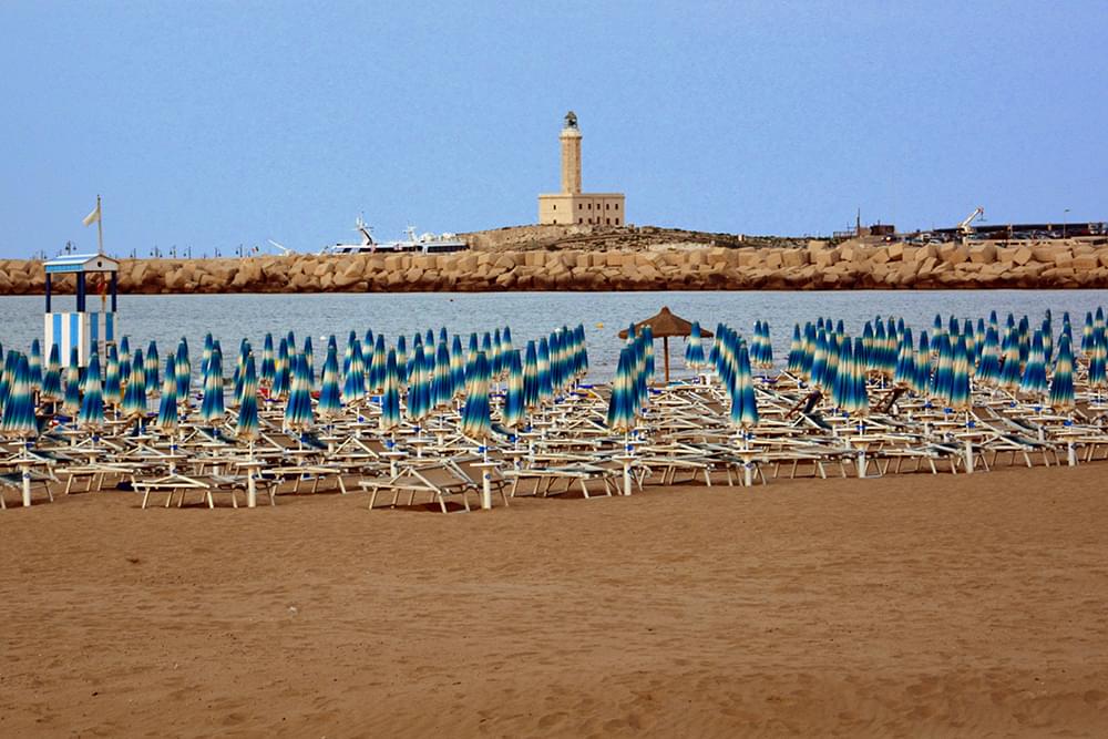
The province of Foggia lies in the northernmost part of Puglia and offers a strikingly diverse blend of landscapes, cultures, and traditions. Often referred to as the “granary of Italy” because of its vast wheat fields, it is also a land of forests, lakes, coastal cliffs, and sacred sites that tell stories dating back thousands of years.
From the windswept plains of the Tavoliere delle Puglie to the dramatic promontory of the Gargano, the province of Foggia holds a unique place in the Italian imagination. It offers visitors a deep dive into rural life, religious devotion, and natural beauty on a grand scale.

The Gargano Peninsula, often called the “spur” of the Italian boot, is one of the most breathtaking parts of the province. Its jagged coastline, hidden sea caves, and white limestone cliffs plunge into the Adriatic, offering panoramic views and secluded beaches. The towns of Vieste and Peschici, perched on cliffs above the sea, are famed for their old quarters and vivid summer life.
Forests of pine and beech rise from the coast into the interior, forming the ancient Umbra Forest. This protected area is part of the Gargano National Park and is a UNESCO-listed biodiversity site, ideal for hiking, cycling, and wildlife observation. The contrast between wild nature and medieval towns is one of the province’s greatest strengths.
Foggia province is one of Italy’s most important destinations for religious tourism. Monte Sant’Angelo, set high on the Gargano cliffs, is a pilgrimage site known since the 5th century. Its Sanctuary of Saint Michael the Archangel is carved into a grotto and recognized as a UNESCO World Heritage Site.
This sacred site has welcomed popes, saints, and pilgrims from across Europe and continues to be a powerful spiritual destination. Nearby San Giovanni Rotondo draws millions of visitors annually to the tomb of Padre Pio, the 20th-century saint whose legacy continues to inspire devotion and charitable works.
The Tavoliere plain, which covers much of the province, is one of the largest agricultural regions in Italy. It is known for wheat, tomatoes, olive oil, and sheep farming. The landscape is wide and open, with historic farmhouses, fields stretching to the horizon, and seasonal festivals tied to the rural calendar.
Despite its farming identity, the Tavoliere also hides rich archaeological and cultural heritage. Towns like Lucera and Troia offer splendid cathedrals, Roman ruins, and fortified castles, revealing layers of history that go far beyond agriculture. This area connects ancient traditions with daily life in a way few places can.
Foggia’s mountainous inland areas offer an entirely different perspective on the region. The Daunian Mountains, located in the west of the province, are home to hilltop villages such as Bovino, Sant’Agata di Puglia, and Accadia. These towns are known for narrow stone streets, traditional festivals, and panoramic views over the valleys.
The castles and towers built in the medieval period remain dominant features of the landscape. The Castle of Lucera, built by Frederick II, is one of the largest in southern Italy and offers a commanding view of the plain. The villages preserve ancient customs and host religious and folkloric events that keep centuries-old traditions alive.
The cuisine of the Foggia province reflects its rural and coastal roots. Dishes are simple but full of character, made from seasonal produce and time-honored methods. The plains produce durum wheat pasta, sheep’s milk cheese, and sun-ripened tomatoes that form the base of many meals.
Coastal cuisine includes fresh seafood, often grilled or preserved in oil, while the inland areas serve hearty stews, roast meats, and legumes. Local wines such as Nero di Troia are gaining prestige, and products like caciocavallo cheese and extra virgin olive oil are staples of both the local kitchen and artisanal export.
Festivals in the province of Foggia range from solemn religious processions to joyous celebrations of food, music, and craft. In Troia, the July patron saint festival features parades, fireworks, and a blend of sacred and folk traditions that animate the town for days.
Music is central to local culture, with ancient rhythms like the tarantella still danced during village feasts. Artisan crafts such as wood carving, lace making, and ceramics continue to be practiced in smaller towns, preserving cultural identities and passing skills from generation to generation.
In addition to the Gargano coast and Umbra Forest, the province offers other natural wonders. Lago di Lesina and Lago di Varano are two coastal lakes that provide unique ecosystems for birds and aquatic life. Their shores are lined with fishing huts, and their waters are used for traditional eel and shellfish farming.
The hills and forests of the inland regions invite adventure on foot or bike. Trails wind through ancient beech groves, pastoral meadows, and dramatic cliffs. Nature reserves and rural areas are open year-round for those seeking peace, wildlife, and the rhythms of untamed southern Italy.
Foggia is well connected by train and highway, with regional airports in Foggia and nearby Bari offering access to the province. A car is recommended for reaching rural and mountainous areas, especially for visitors interested in exploring small towns and nature reserves.
Spring and autumn are ideal times to visit, with pleasant weather and fewer tourists. Summer is best for beachgoers and festivals, while winter offers a quieter, reflective atmosphere, particularly suited for religious tourism and enjoying local cuisine by the fire.
The province of Foggia is a place of remarkable contrasts, where the solemnity of pilgrimages meets the joy of folk festivals and where windswept plains give way to forested mountains. It is a land of deep roots, enduring faith, and enduring hospitality.
Whether you are walking the paths of saints, tasting traditional foods, or exploring nature at its wildest, Foggia offers a rich and varied journey through a lesser-known but deeply rewarding part of Italy’s southern soul.

More Details


