Located in Italy’s northeastern Veneto region, the province of Rovigo offers a unique blend of landscapes shaped by the waters of the Po and Adige rivers.
It’s a land where nature, agriculture, history, and tradition converge, forming a tranquil, lesser-known destination full of authentic Italian character and rural charm.

Province of Rovigo, Veneto
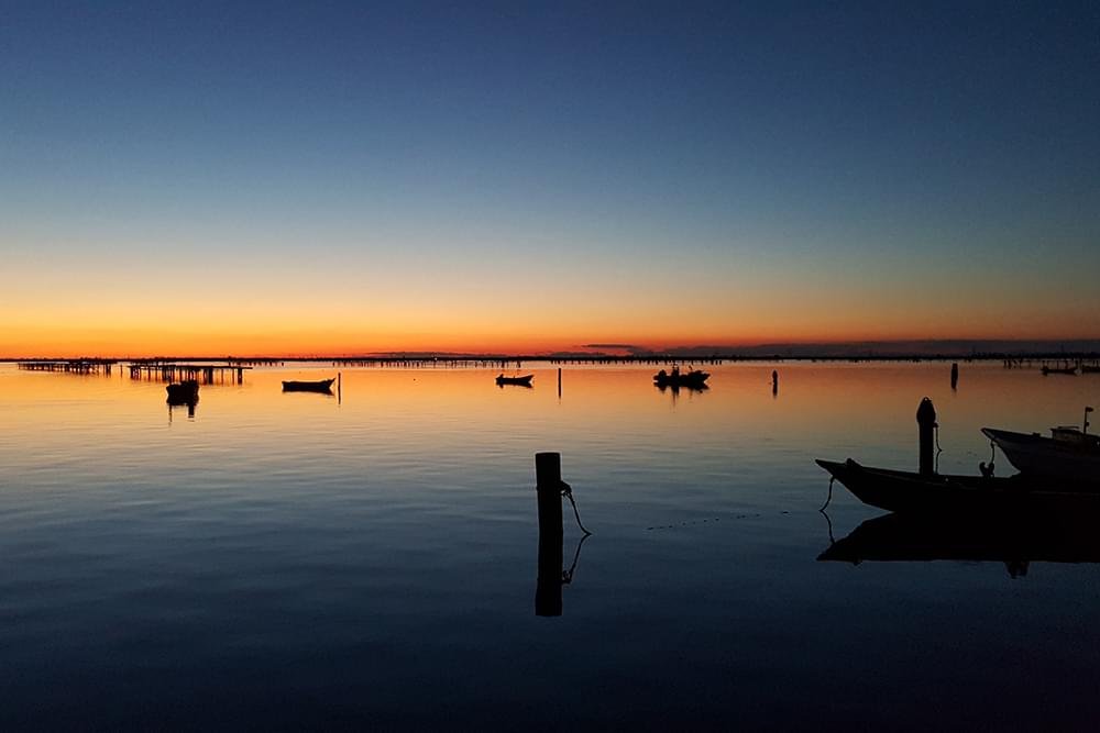
The Po Delta: A Natural Treasure
The Po Delta is Rovigo province’s most distinctive feature, a vast wetland and biosphere that is one of Europe’s most important ecological areas.
This complex network of canals, lagoons, marshes, and sandbars is home to flamingos, herons, and rare species, offering stunning scenery and endless birdwatching opportunities.
Waterways and Life on the Rivers
With two major rivers flowing through it, the province has a deep connection to water. The Adige and Po rivers have shaped both the land and the culture of Rovigo.
River cruises, canoeing, and walking paths along ancient levees provide relaxing ways to explore the region and connect with its agricultural heritage and peaceful rhythm.
Historic Towns and Cultural Landmarks
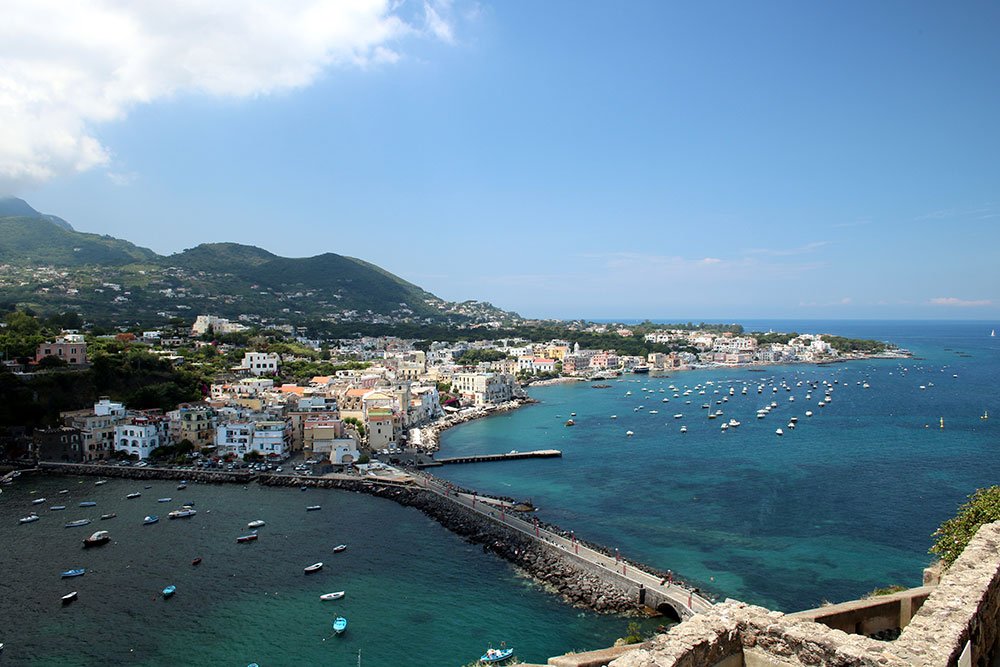
The towns across Rovigo province reflect centuries of history. While the city of Rovigo serves as the cultural hub, smaller towns like Adria and Lendinara preserve medieval and Roman legacies.
Adria is particularly famous as the ancient port that gave the Adriatic Sea its name, and archaeological finds from this era can be seen in the National Archaeological Museum of Adria.
Medieval Castles and Renaissance Palaces
Rovigo province is dotted with fortified structures and noble residences that tell the story of shifting powers and rich local traditions.
The Castello Estense in Arquà Polesine and the villas of Fratta Polesine, including the stunning Villa Badoer by Palladio, are among the province’s architectural highlights.
Countryside, Agriculture, and Rural Beauty
Vast flatlands stretch across Rovigo province, rich with fertile soil thanks to the rivers. This area is a vital agricultural heartland producing rice, maize, fruit, and wine.
Farmhouses, canals, and quiet country roads offer a peaceful landscape for cycling or driving through, with frequent opportunities to sample local produce and traditional food.
Cuisine Rooted in the Land and Sea
The food of Rovigo province reflects its geographical duality, both coastal and rural. It features freshwater fish, eel, rice dishes, and hearty farm-grown vegetables.
Polenta is a staple here, often served with stewed meats, fish, or mushrooms, while wines such as Merlot and Pinot Grigio from the Lison-Pramaggiore DOC area are widely enjoyed.
Festivals and Living Traditions
Rovigo province preserves its customs through a variety of local festivals celebrating agriculture, saints, and seasonal traditions, often accompanied by music and food fairs.
Events like the Rice Festival in Porto Tolle or the historical re-enactments in Lendinara are deeply rooted in community life and reflect the enduring spirit of the province.
The Quiet Appeal of Slow Travel
Rovigo province is perfect for travelers seeking off-the-beaten-path experiences. It offers calm, unhurried exploration through bike tours, nature walks, and heritage routes.
The Po Delta Park is ideal for eco-tourism, while agritourism accommodations and local guides help visitors immerse themselves in the tranquil life of the region.
Accessibility and Regional Connections
Although peaceful and rural, Rovigo province is well connected. It lies between Verona and Venice, and can be reached by train or car from major Veneto cities.
From Rovigo’s central station, visitors can easily explore surrounding towns, or venture south toward the delta and coast, where water meets sky in spectacular horizons.
Why Visit the Province of Rovigo
The province of Rovigo invites you to slow down and experience Italy through a different lens, one of nature, history, water, and tradition without the crowds.
Whether watching flamingos in the Delta, exploring ancient ports, or savoring local wine in the countryside, Rovigo promises authentic, soul-refreshing travel.